
A GIS can also be used to manage urban mobility because, let us not forget it, GIS are decision-support systems.
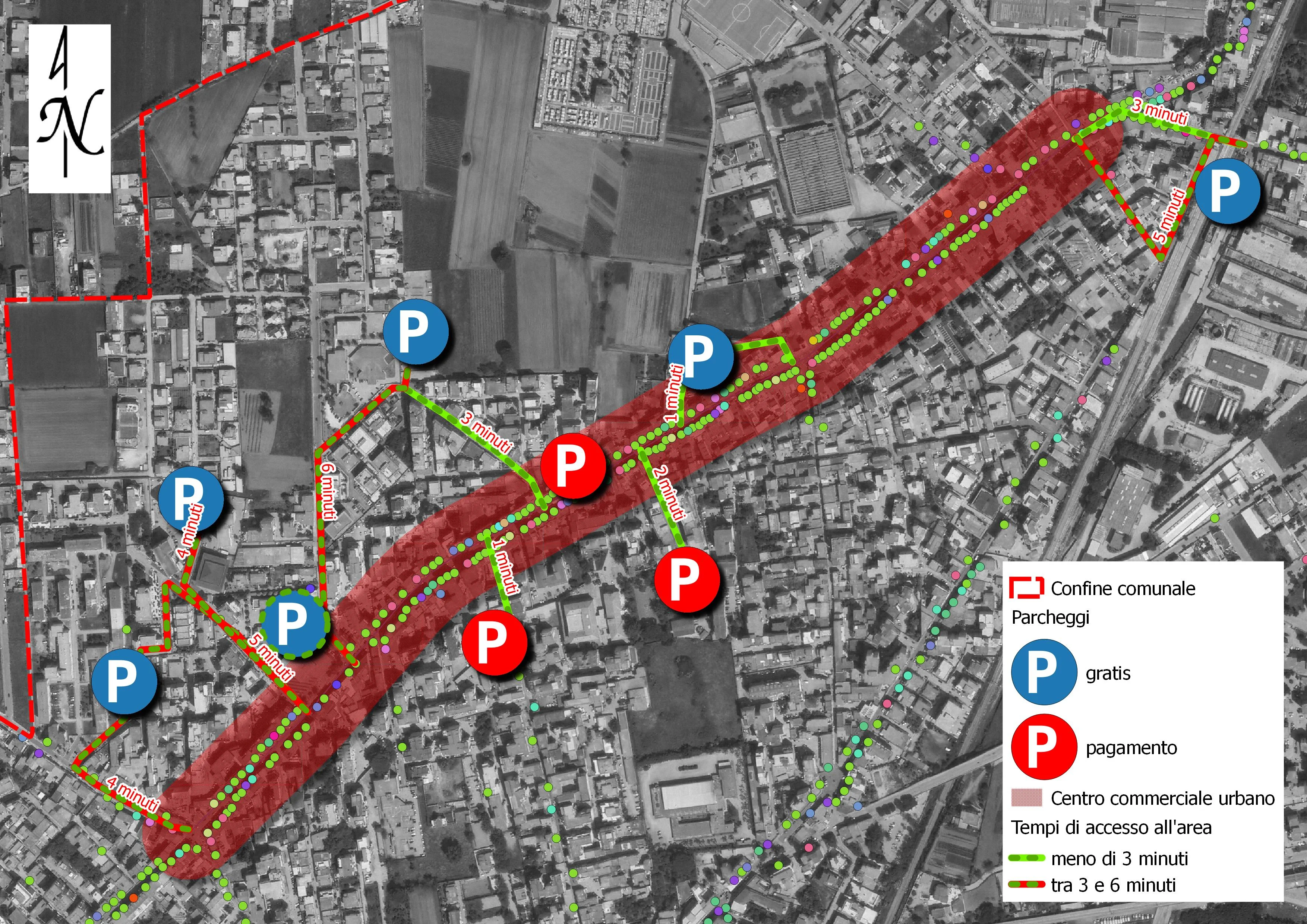
Let us examine a practical case. We need to redistribute and integrate parking areas within an urban zone with a high density of commercial activities.
With a proper urban-mobility analysis carried out using GIS methods, we can identify not only the areas where new parking facilities should be created, but also evaluate their accessibility.
Another practical example in which GIS can support urban mobility management concerns cycling mobility.
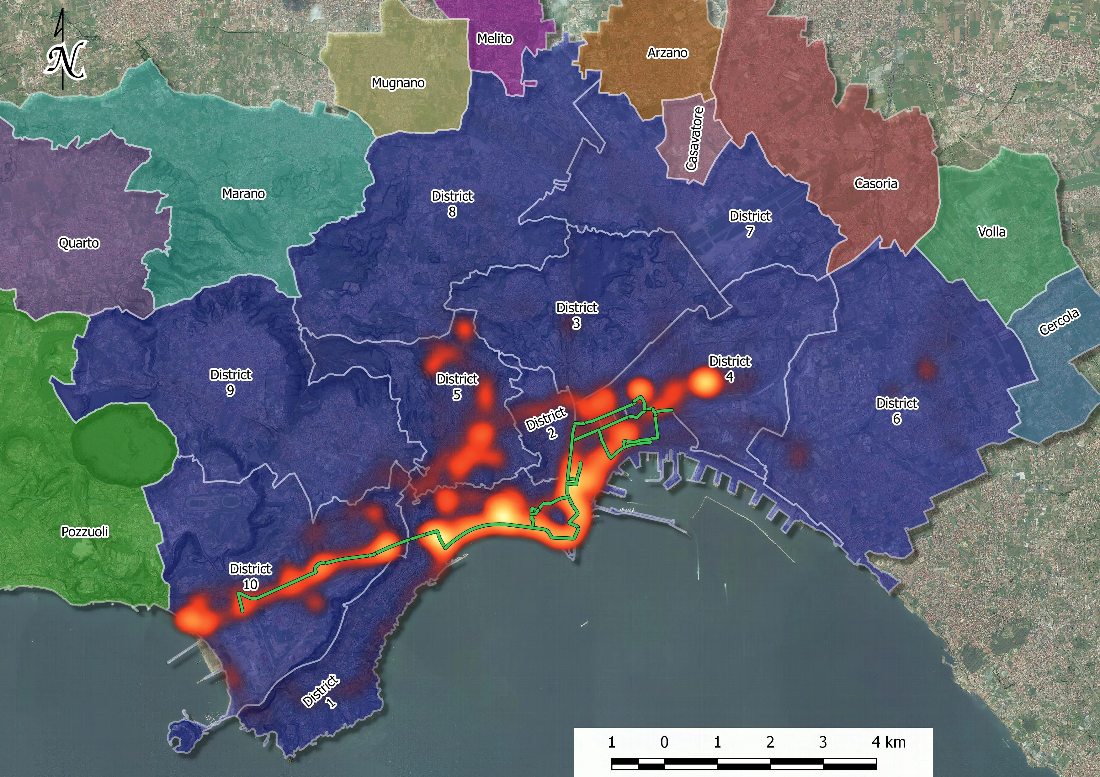
The previous image is part of a study carried out to assess cycling mobility in the city of Naples. Travel data were analyzed with methods borrowed from both transport engineering and GIS methodology.
It was possible to evaluate the real use of the bike-lane sections, shown in green, and to identify future sections to be built where the heat map reveals concentrations of cyclist flows outside dedicated cycling routes.