
The Italian Highway Code, through article 13, paragraph 6, establishes the Road Cadastre. The rule requires road authorities to create and keep updated maps, the road cadastre, and related assets.
Road authorities are required to establish and keep updated the cartography, the road cadastre, and their related assets according to the procedures defined by ministerial decree. The cadastre must also include the permanent systems and services connected with road traffic.
The implementation framework arrived in 2001 with the Ministerial Decree of June 1, 2001: Methods for establishing and updating the Road Cadastre. The decree relies on the European GDF standard, especially the Roads and Railways section.
GIS play a key role in building a road cadastre because they allow the descriptive levels required by the decree to be modeled and explored. Without going too deep into the legal text, the decree works on three levels:
- level 0: the road infrastructure is described through geometric primitives such as points, polygons, and lines, making it suitable for pure cartographic representation;
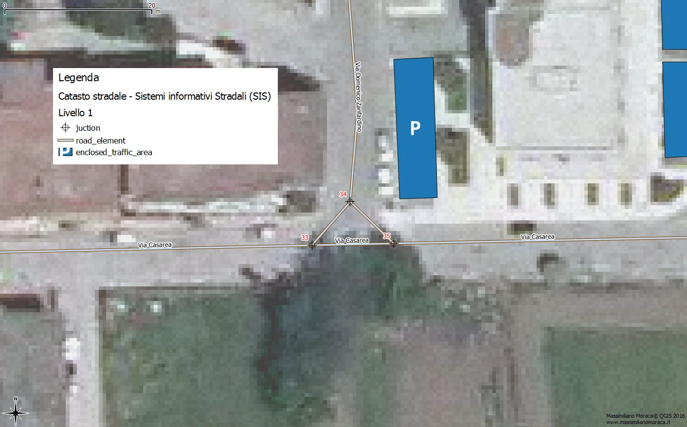
- level 1: the infrastructure is described at large scale through three core elements, junction, road element, and enclosed traffic area; this is the reference level at the base of the cadastre;
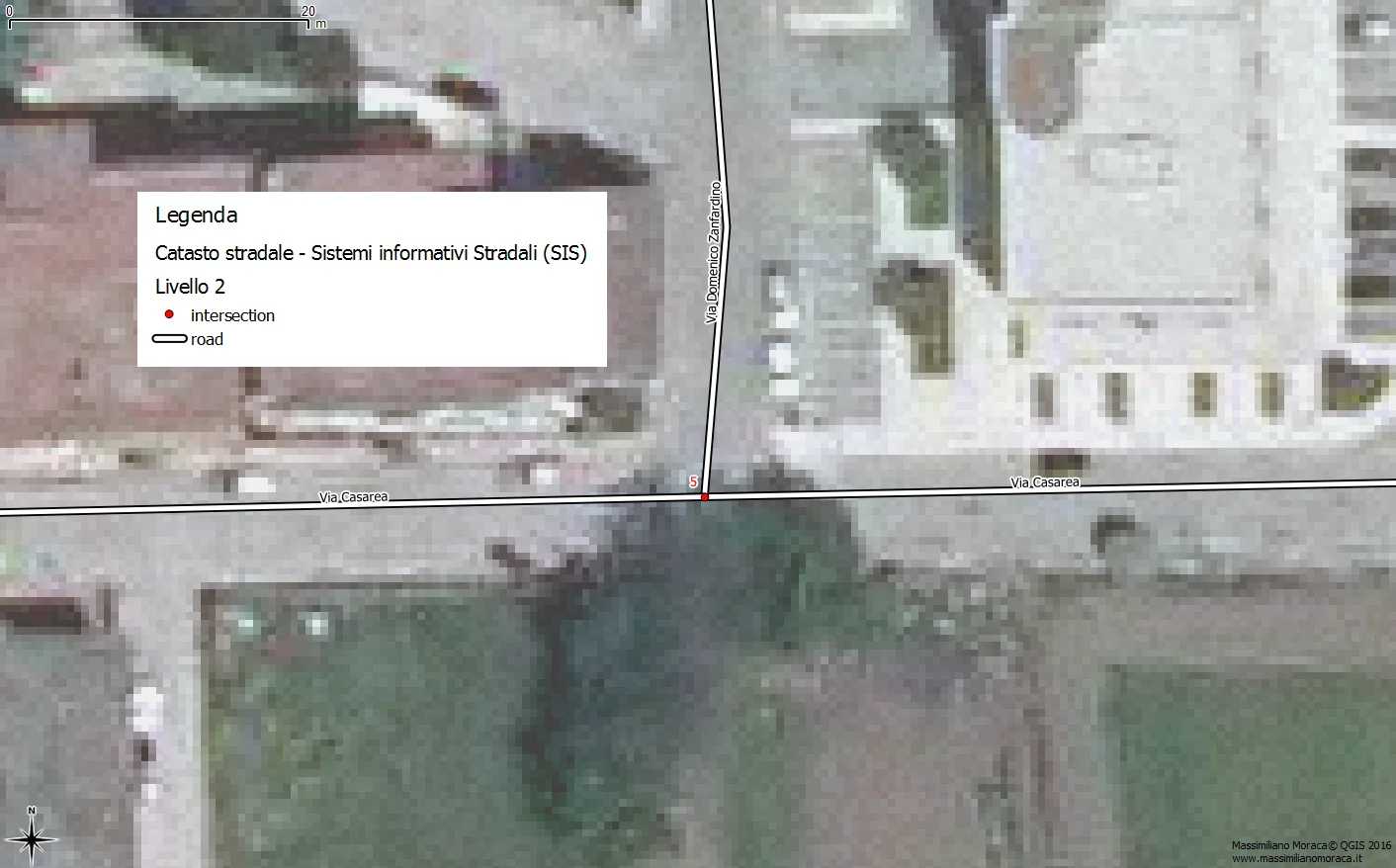
- level 2: the infrastructure is described through roads and intersections, working at a smaller scale than level 1.
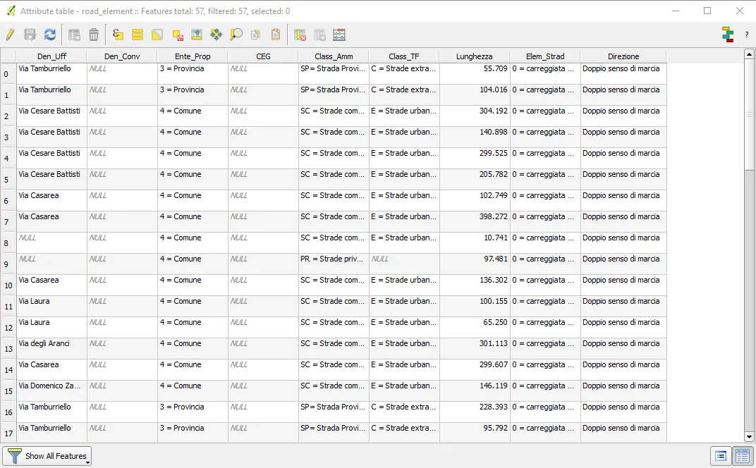
Below is an example of an attribute table for the road element vector layer.
Even without covering every technical detail, these examples show clearly why GIS are central to the implementation of a proper road cadastre under article 3 of the decree.