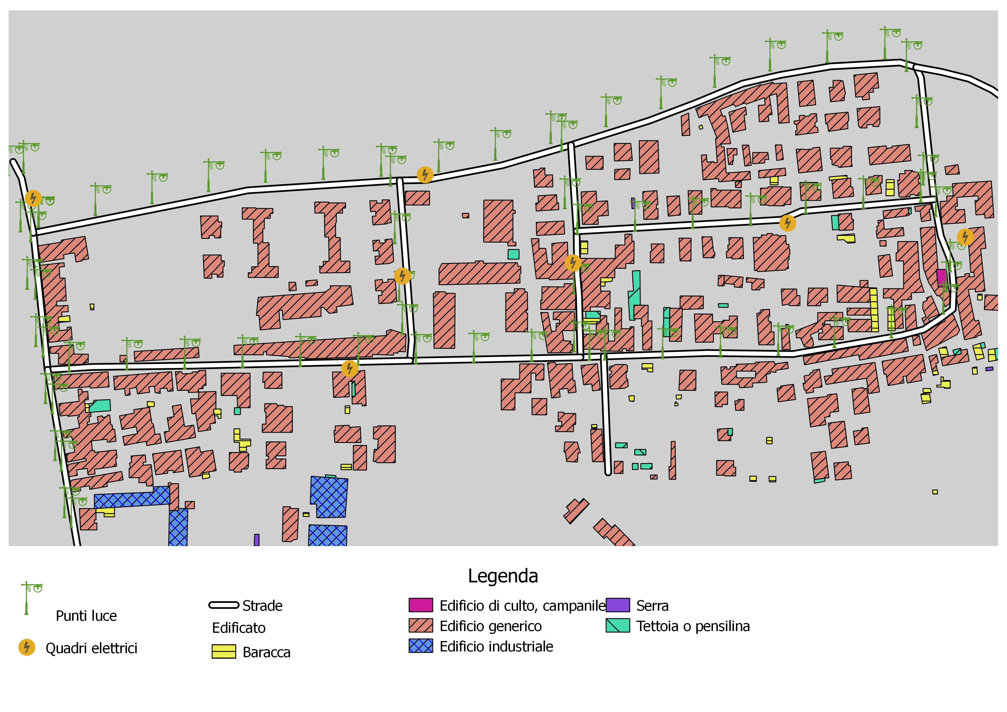
A public lighting inventory is a good practice not only because it identifies the location of public lighting assets, but also because it helps quantify energy consumption and design strategies to reduce operating costs. Building this inventory also moves an area one step closer to the idea of a smart city.
Concrete examples are easy to find online. For instance, the Municipality of Lissone used its inventory to quantify energy consumption and then launched a public tender aimed at reducing both energy use and costs for citizens.
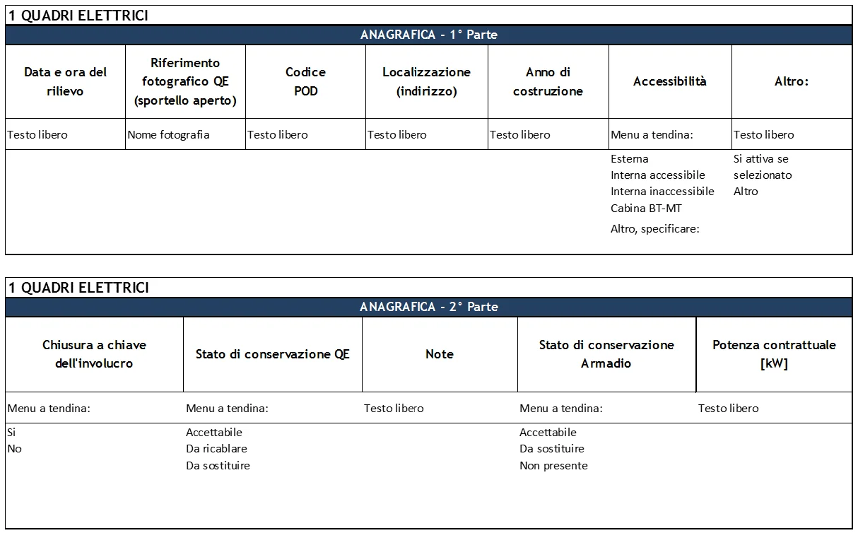
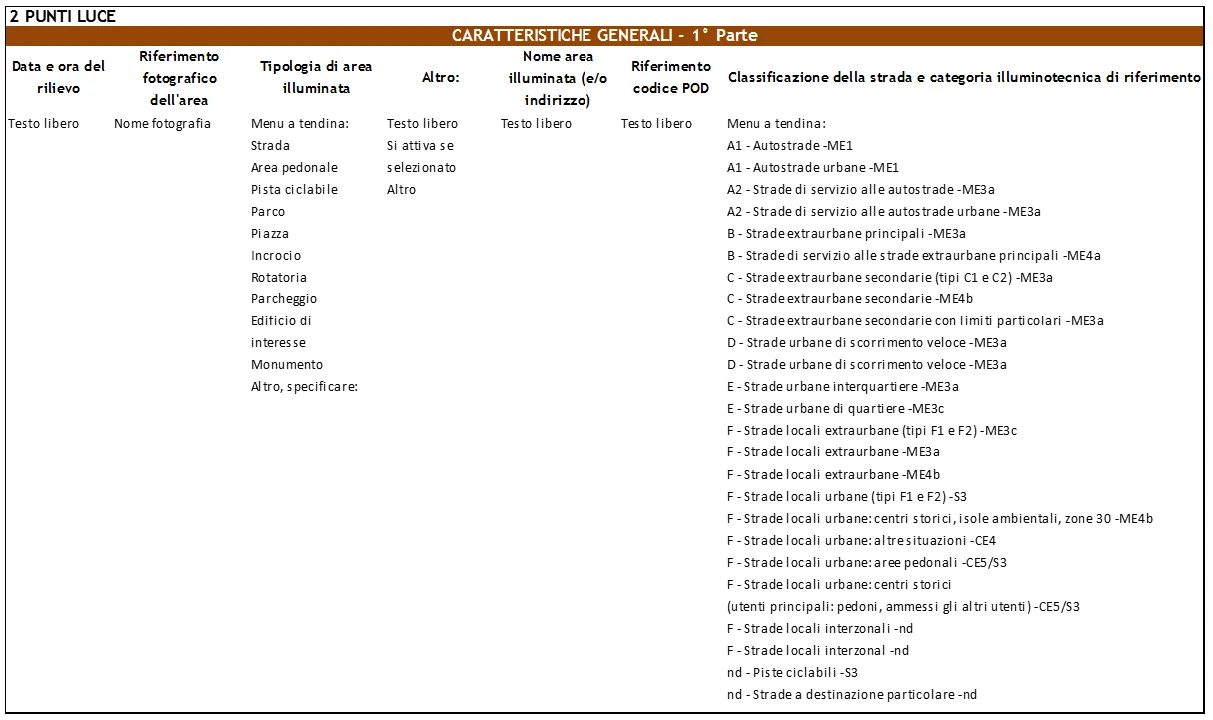
Within the Ministerial Decree of June 1, 2001, which provides the implementation rules for the road cadastre, there is also a reference to road-light positioning, whether axial, lateral, or other. In addition, an ENEA working group produced a practical form for surveying public lighting, and that structure can easily be reproduced inside a GIS, ideally supported by a geodatabase.
The forms prepared by the working group include an indispensable module for municipal registry data and four additional modules: electrical panel inventory, light-point inventory, electricity-consumption acquisition, and maintenance acquisition.
This study belongs to the Lumière Project, an ENEA initiative created to promote energy efficiency in public lighting and support municipalities in planning and implementing improvement actions.
Lumière is a research and technology-transfer project structured by ENEA to promote energy efficiency in public lighting, especially through the reduction of electricity consumption in municipal lighting systems.
The project is dedicated to municipalities, mayors, and administrators, helping them improve planning capacity and technical awareness in the energy management of their territory.
The A GIS for... series is not intended as a step-by-step manual. Its goal is to show where GIS can make a practical difference, so the images below are illustrative rather than exhaustive.