In recent years agriculture has seen a growing number of survey techniques in which GIS methods also play an important role.
Just think, for example, of precision agriculture:
Precision agriculture is a management strategy for farming that relies on modern instrumentation and aims to carry out agronomic interventions while taking into account the actual needs of crops and the biochemical and physical characteristics of the soil.
Source Wikipedia
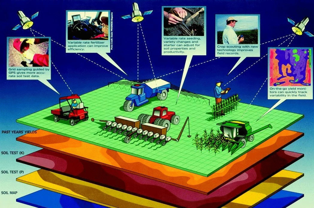
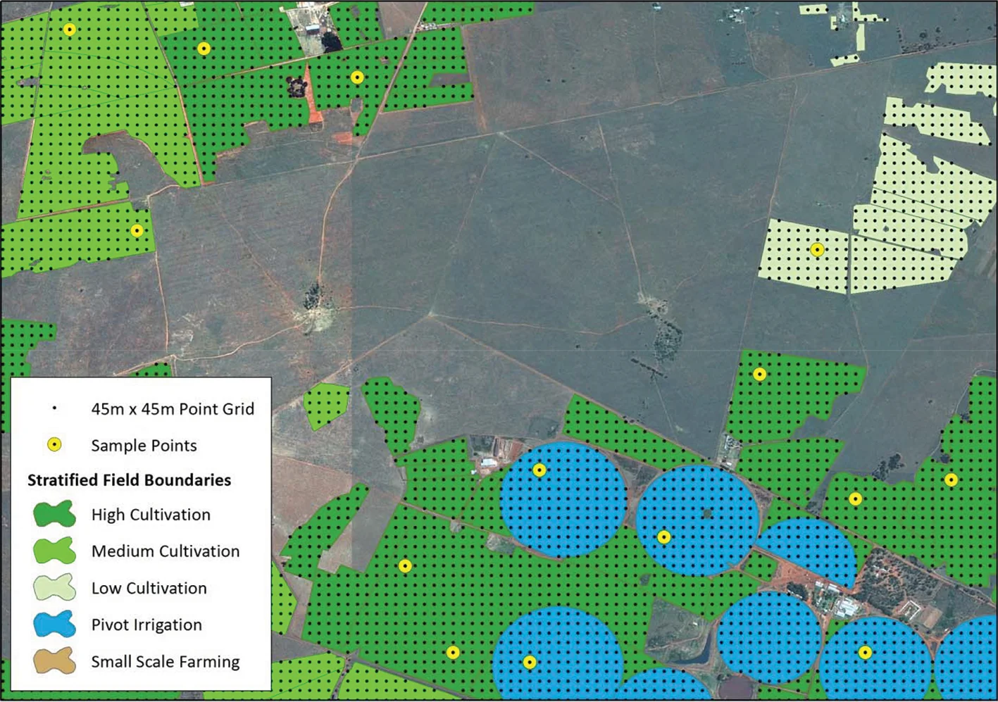
With precision agriculture it is essential to geolocate the agricultural field, the orchard, and even the individual plant. This allows modern farmers and the agronomists who support them to carry out targeted interventions.
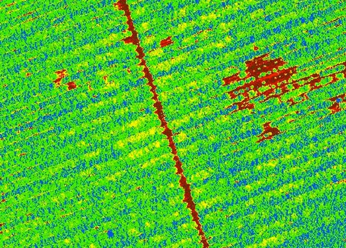
It is possible, for example, to carry out thermographic surveys:
Thermographic survey techniques also find room and practical application in agriculture, providing a considerable amount of qualitative and quantitative data on crops, advancing plantation-control systems and enabling real prevention on crops. All this allows us to obtain a product of higher quality in every respect.
One of the latest applications of thermal infrared, which is becoming increasingly common among professional farmers, is the assessment of proper irrigation over large agricultural fields, making it possible to determine the effectiveness of irrigation systems and avoid crop stress caused by poor soil irrigation.
Thermographic diagnostics in agriculture include:
Checking water stress in crops.
Checking the condition of trunks in fruit or timber trees.
Checking soil moisture.
Checking that plant internal temperature is within the correct range.
Source MicroGeo
Designing a GIS that supports specialized operators in making the right decision about the intervention to be carried out is one of the many fields of application of GIS methods.