
Looking at the succession of data, from 2000 to 2012, of the Corine Land Cover it might seem that all in all the way in which the land in Campania is exploited (for antropici and not) is remained unchanged. But it's By studying the third level of the Geographical DB of the project, we discover great and, in my opinion, worrying truths.
In the following table I have grouped the individual categories of the Corine Land Cover in the three censuses, adding the areas; then I made a difference between the same categories at different years. Areas in decline compared to the previous census are highlighted in red. A hectare (ha) is about a regulation 11 football pitch.
How can you note the "Continuous urban fabric" is gradually decreasing in a fairly constant manner, it might seem like a positive thing but by looking at the "Discontinuous urban fabric" you notice how this has increased in an equally constant manner. For comparison, in Campania, the municipalities of Lacedonia and San Bartolomeo in Galdo have a very similar extension to the expansion of the discontinuous urban fabric. Between 2006 and 2012 Campania therefore "acquired" two more municipalities in terms of anthropization and land consumption. Let's not be fooled by the wording "Discontinuous urban fabric" because it is it also takes up space from the natural soil as it requires of road infrastructures, underground services, works that make the ground waterproof. And in fact there is also an increase in road networks. The question I ask myself is:
Given an increase in road networks was there a parallel improvement of the pre-existing road fabric?
Still remaining in the macro area of "Built-up areas" there is also a significant increase in industrial sites, mining extraction areas and landfills. Not wanting to see everything grey, the data regarding the increase in "Urban green" gives us hope; it is hoped that the same increase will also be detected in the next version of the Corine Land Cover.
The losses in the "Agricultural areas" macro area could be read as a slow but constant loss of agricultural land and more in general of the care that farmers of the past put into maintaining the fields and non-wooded areas such as pastures, which are also in decline. Not having an agricultural background, I don't know how to give other readings.

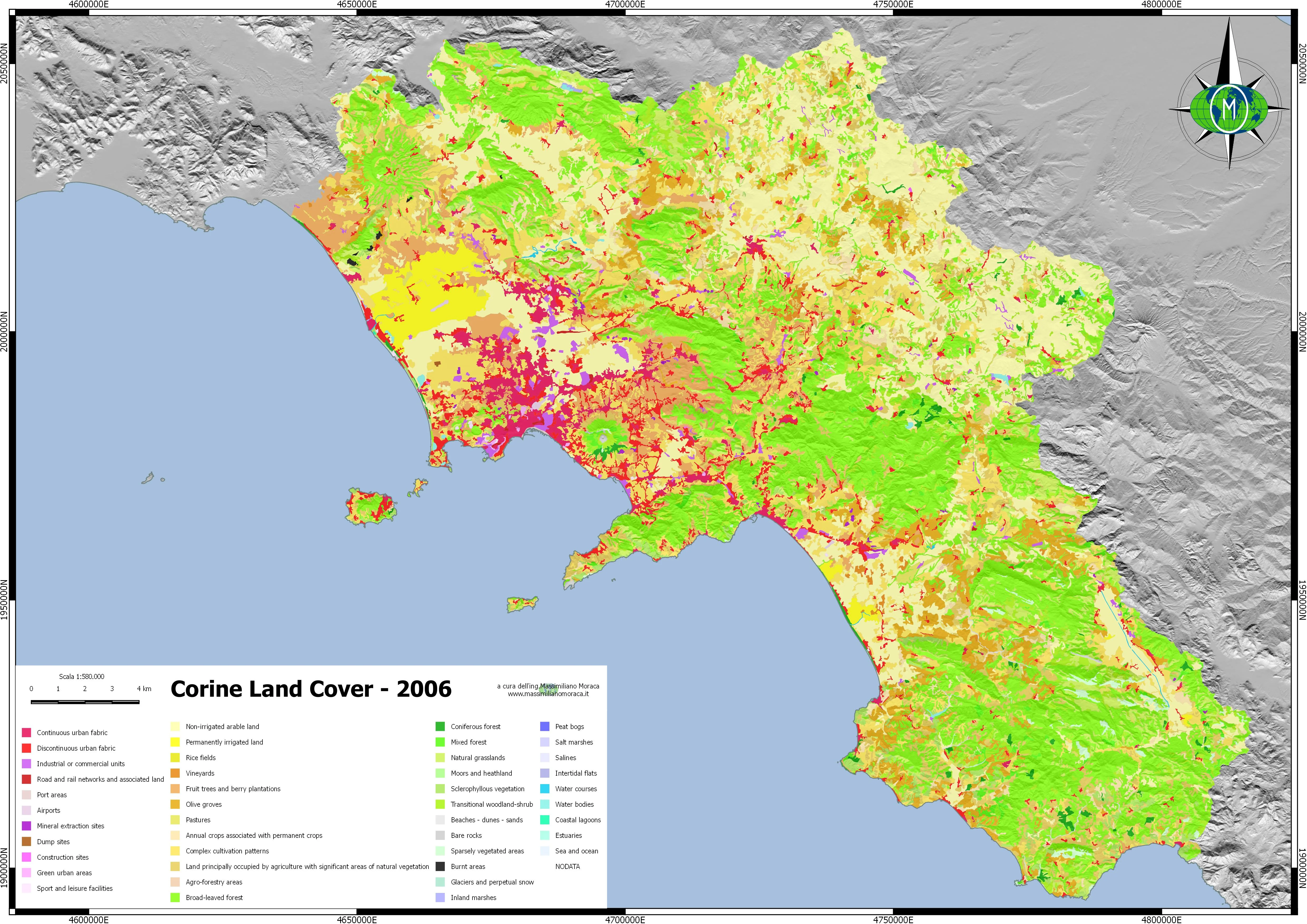

Not even the woods are doing well in Campania. Almost all the categories of the third level of the CLC of the macro area "Forest and natural areas" are in red and the phenomenon of summer fires alone is not enough to explain the slow but inexorable disappearance of the Campania woods. The sum of the minuses of the wooded areas almost comes close to the extension of the anthropized areas and in particular of the discontinuous urban fabric. The wooded areas play an important role both in regulating the temperature of the areas close to them and in relation to rainfall events as they retain rainwater ensuring that little water reaches the ground, thus avoiding phenomena of washout of the superficial layers of the soil or worse phenomena such as landslides; they also host various faunal species. Another reflection that comes to mind is:
What did you do? done in recent years at a regional level and not to mitigate the phenomena of hydrogeological instability in a Region already in itself with major "instability" problems?
Lastly, the reduction of internal marshy areas and waterways in favor of the increase in bodies of water suggests an increase in the industrial/civil use of the power of moving water or in any case its storage in basins for drinking use.
What actions have been implemented by the authorities? of the Basin and by the managing bodies and service providers so that Is the quantity of water lost through damaged pipes reduced, if not cancelled? How have local flora and fauna been protected by the reduction in water supply?
This analysis was done by working on public data that can be freely downloaded by anyone. Anyone wishing to carry out further analyzes will be able to download the data already reworked and attached to the article; the data is in GeoPackage.
format