Can GIS support investigative journalism? Absolutely. Placing an event, or the subject of an investigation, on a map is a powerful way to obtain a clearer overall picture.
An example of how GIS can support investigative journalism is the article below, based, unfortunately, on events that really happened over the last few years in the municipality where I live, Casalnuovo di Napoli.
Is It the Roma People's Fault?
Premise: read the whole article before focusing on the title, then comment if you wish.
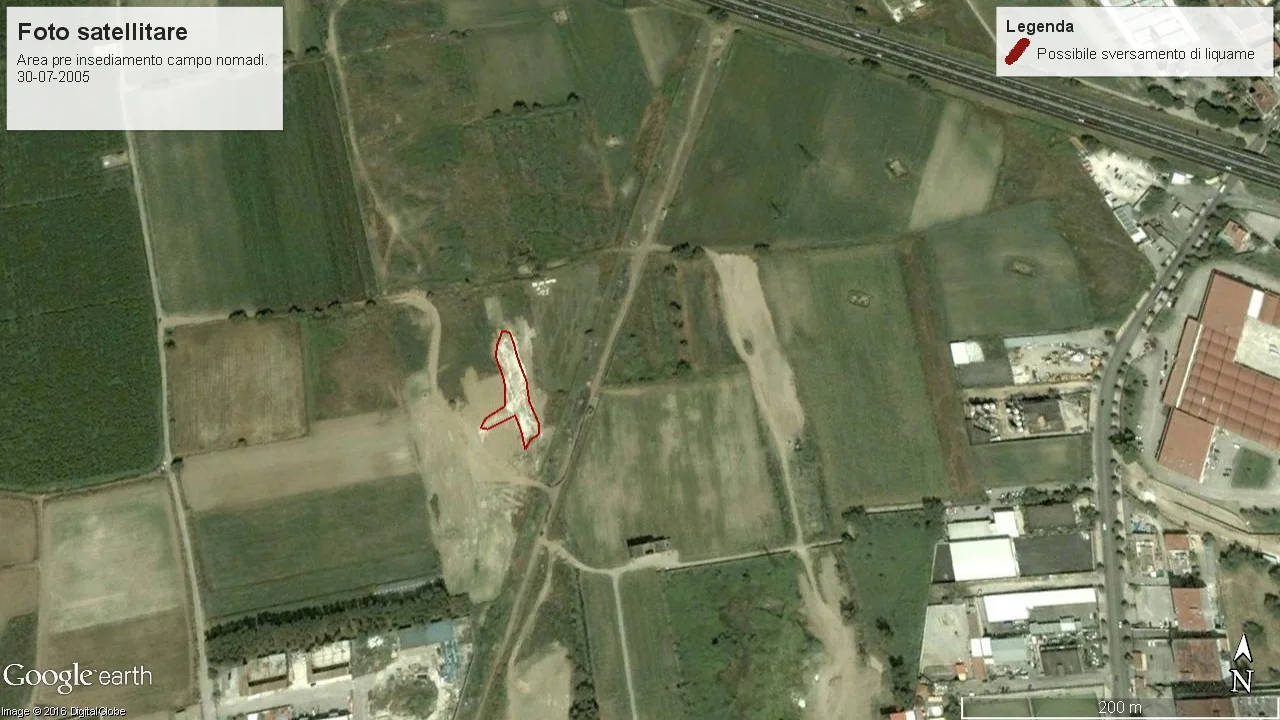
In July 2005, in the area where, a few months later, work on the high-speed rail line would begin and the Roma camp would be established, a strange patch appeared. It was clearly not natural and looked very much like some kind of wastewater spill.
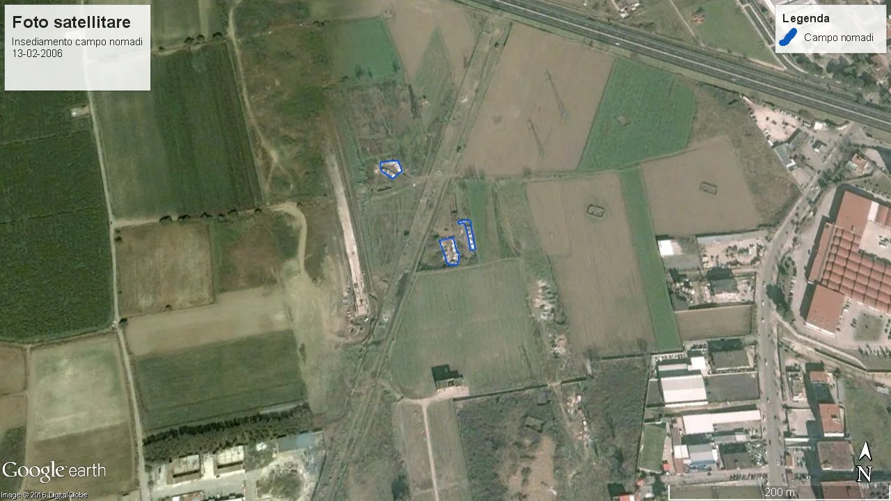
A few months later the camp residents arrived, and in the area corresponding to the stain in the previous image the first work for the high-speed rail line began. This is February 2006.
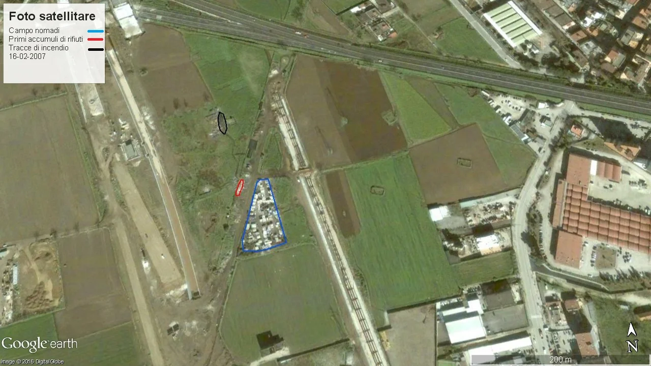
By February 2007 the camp had a larger extent than in the previous survey. There was a small accumulation of waste and a burn area located away from the camp.
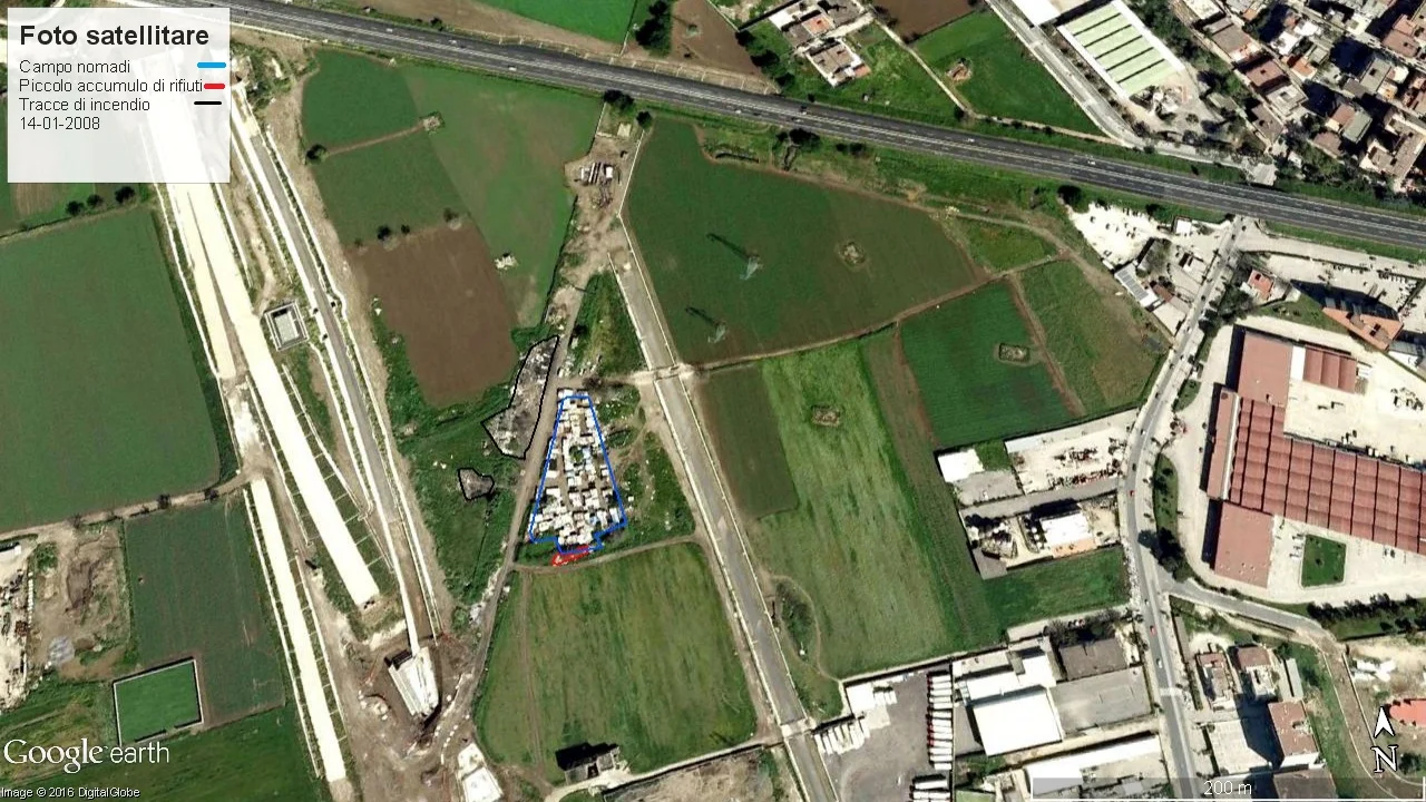
In January 2008 the extent of the camp was almost unchanged, as was the landfill, while the burned area was larger and close to the camp.
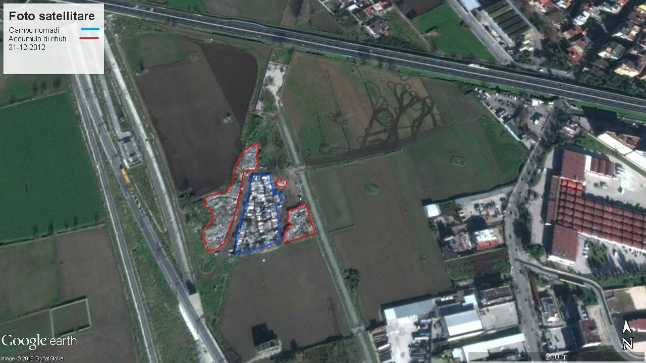
By May 2011 the camp had not changed significantly in size compared with the previous survey, while the landfill had grown considerably. The satellite image refers to the survey published by the Ministry for the Environment in 2012, but as the metadata state, the actual survey was carried out in May 2011.
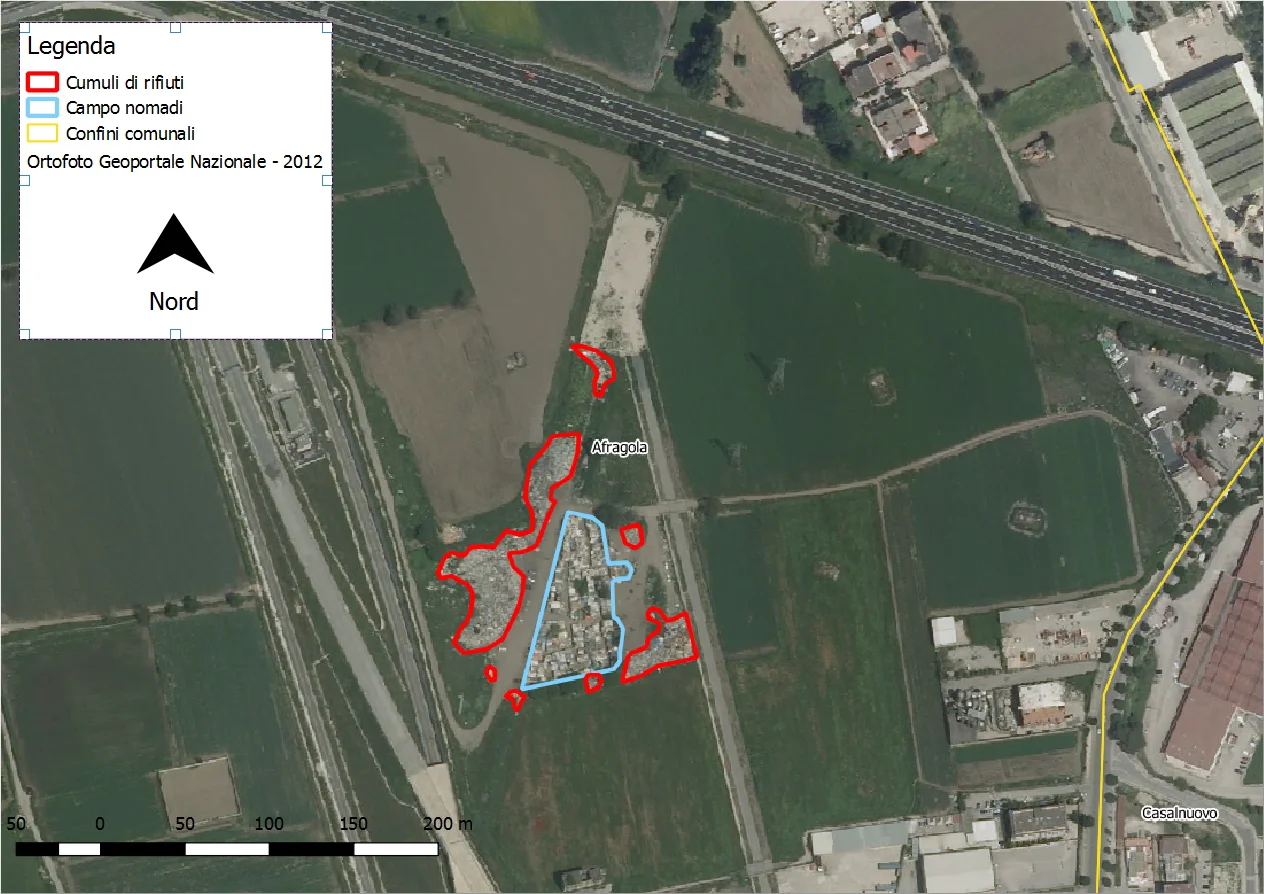
The situation remained almost unchanged in December 2012.
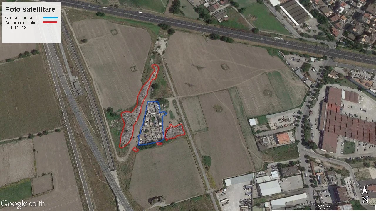
Almost everything remained unchanged in June 2013.
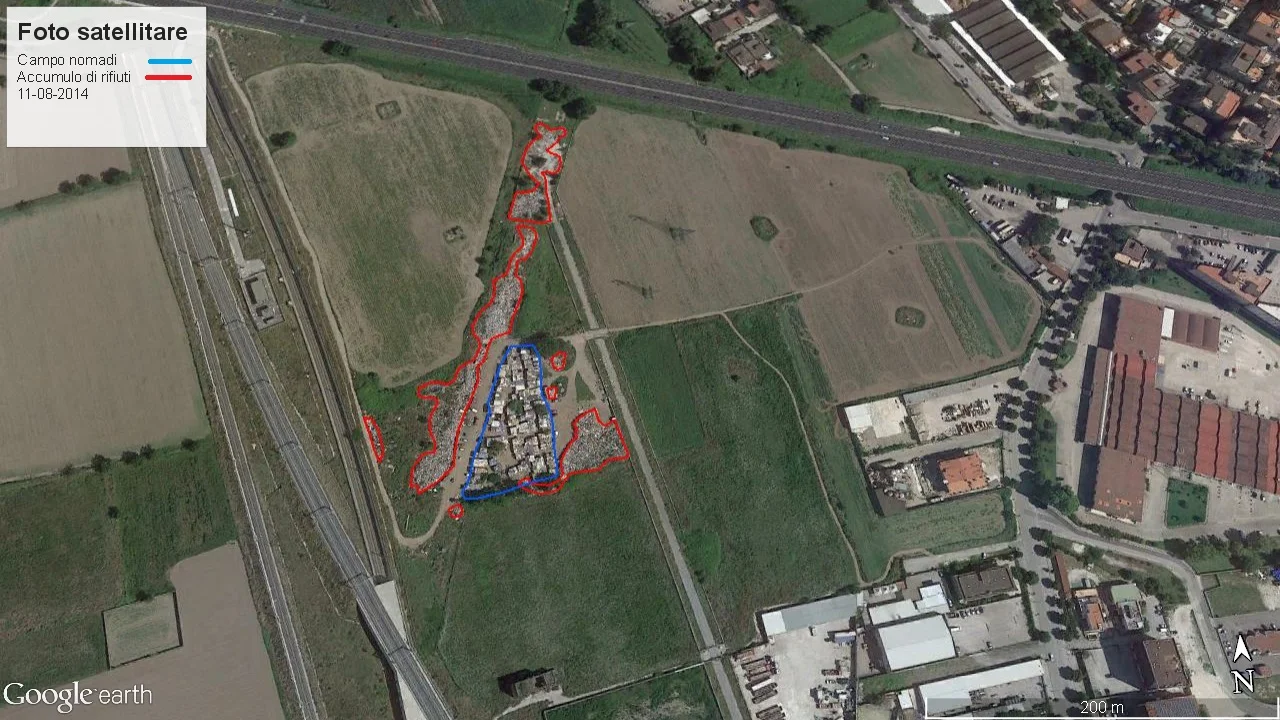
A substantial increase in the landfill can be seen in August 2014.
It is not possible to go further with the surveys because data are missing from both Google Earth and the Ministry.
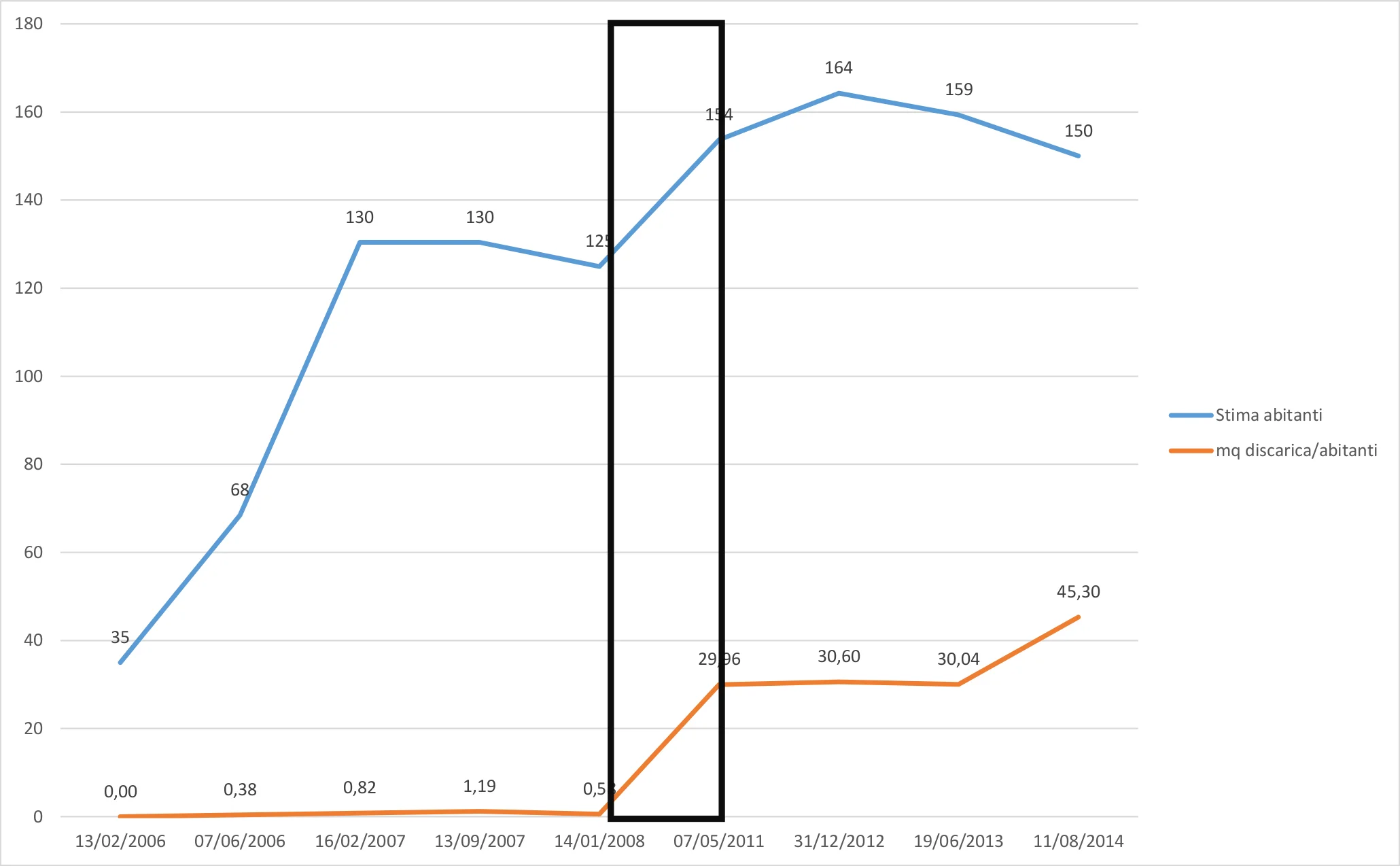
It has been estimated, or at least that is what several newspapers reported, that when the Roma camp was cleared there were about
150 people living there. This is the figure used in the estimates below, reworked backwards over the years with a simple proportion.
As the chart below shows, the increase in the camp area can be associated with an increase in the landfill area, with a fairly constant relationship until 2008. The ratio between camp area and landfill area remained far below one, reaching 0.05 in 2007. We can assume that at least until January 2008 the landfill consisted of self-produced waste. Every human activity generates waste that must be disposed of somehow. Something changed between 2008 and 2011.
From 2011 onward that ratio reaches and exceeds one, rising to 1.19 in 2012. Until 2008, each inhabitant of the camp had at most nearly 1.2 square meters, according to the 2007 figure, available as landfill area. After 2008, even though the population increased only by a few dozen people, each resident started occupying a larger and larger surface of land to be used as landfill. That surface reached 45.30 square meters in 2014.
How is this possible? The area of the camp is more or less the same, but the surface of the landfill increased by 98%, became larger than the camp itself, and kept growing over the years even while the camp was shrinking in both area and population.
The questions raised by this “study” are many.
The Roma settled there in 2006.
Why did no local, provincial, or regional administrator follow up on the Formez guidelines aimed at integrating Roma communities? Still on the subject of integration, the camp residents could have been taught how to separate waste, with collection arranged for the modest amount of waste they produced until 2008.
What happened between 2008 and 2011? Around those years the crisis known as Terra dei Fuochi began, and soon after even
the national media became aware of it.
Who brought the waste to the Roma, and why did nobody stop this devastation?
The title of this note is “It Is the Roma's Fault”, but who are the Roma? That population of little more than one hundred people that settled in the area and, until 2008, clearly produced waste only for its own use, or those who over the years brought and dumped every kind of waste there, even paying the camp residents (
Italians, Good People was the title of a film)? Or are they instead the institutions that never did anything to prevent what happened over the years and still happens now, namely that the camp, empty for months by then,
caught fire once again? A camp under seizure, monitored by the army.
Conclusions
I do not know whether this can properly be called an inquiry or an investigation, but an ordinary citizen like me can carry out analyses using satellite images that are freely available, from both private companies (Google Inc.) and public bodies (Ministry for the Environment). Did those who were supposed to monitor the area and investigate ever carry out analyses like these? Not to mention that a public authority could have access to an even denser historical archive of satellite images than the one I was able to assemble.
I apologize to professional journalists if what I wrote cannot strictly be defined as investigative reporting, but it was written to show the potential of a tool that, when placed in the hands of those who do investigative journalism, can have a strong impact.