Some time ago I wrote the column "A GIS for..." with which I tried to give some indications on how and why GIS systems are essential and very useful as decision support tools.
In one of the articles in that column I talked about geomarketing and it is precisely with a small application of geomarketing methodologies that I want to talk about gambling addiction.
What is gambling addiction?
Pathological gambling(also calledgamblingpathyor generically and improperlyludopathy) is a a behavioural disorder falling into the category diagnosis of impulse control disorders.
In the May 2013 edition of DSM gambling is been classified in the category of the so-called "behavioral addictions".[1]
Source WIKIPEDIA
So gambling addiction is a behavioral disorder, as I do not deal with people's behavior, I am not able to "indicate medical paths/solutions" for this pathology, but I believe that with a careful analysis of the territory it is possible to identify areas in which it can be the incidence of this pathology may be highor in any case the excessive concentration of activity which can potentially "generate" people affected by this pathology.
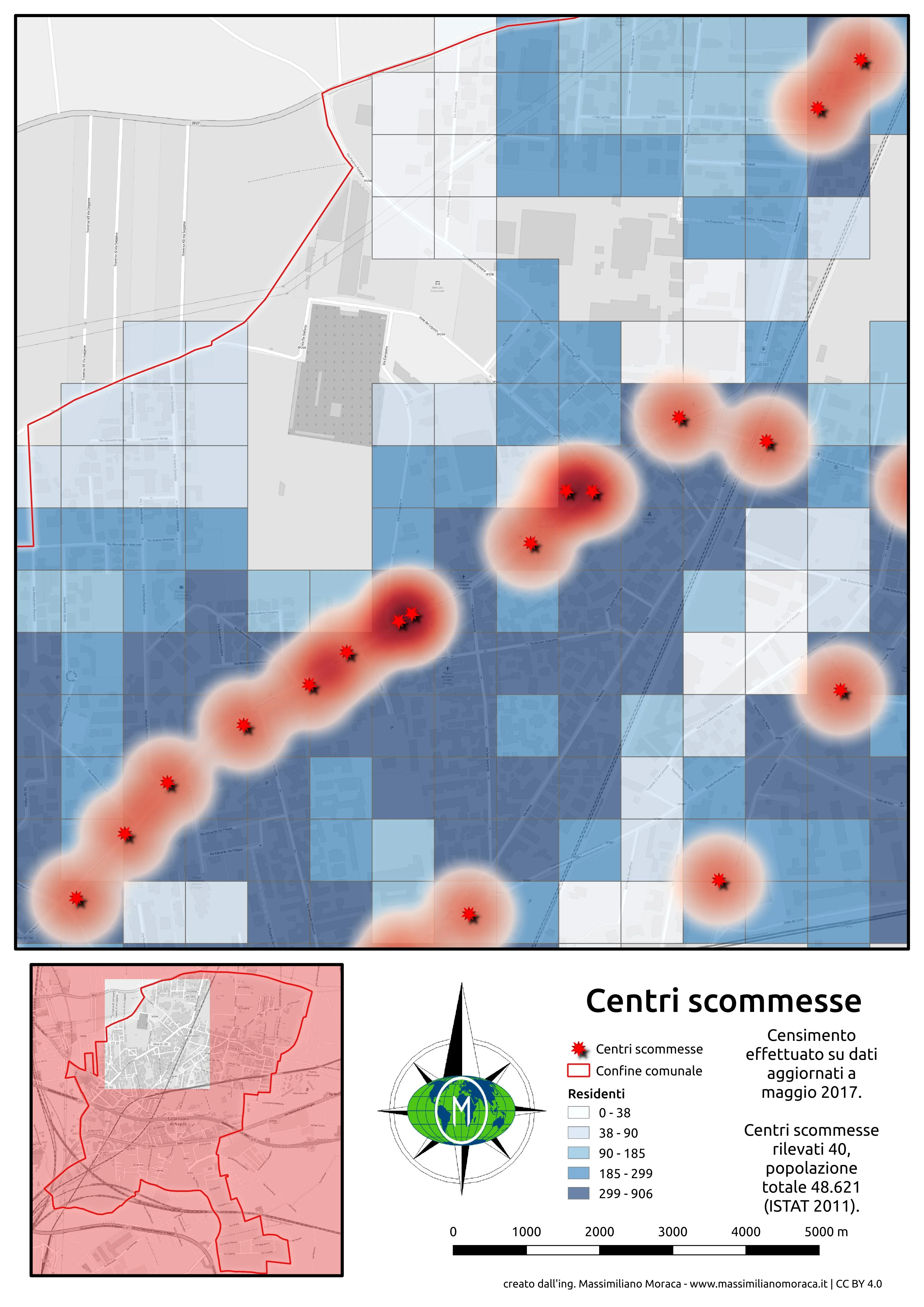
Userò the geographical database that I have created and expanded over the years, relating to my current municipality of residence, Casalnuovo di Napoli.
Casalnuovo is a large town on the north-eastern outskirts of Naples, with a population of almost fifty thousand inhabitants which, as can be seen in the following video which I made a few months ago for the analysis of data on the PUM, has a density housing in continuous growth.
The north-west area of Casalnuovo is the most densely inhabited and is It is precisely here that most of the city's betting centers are concentrated.
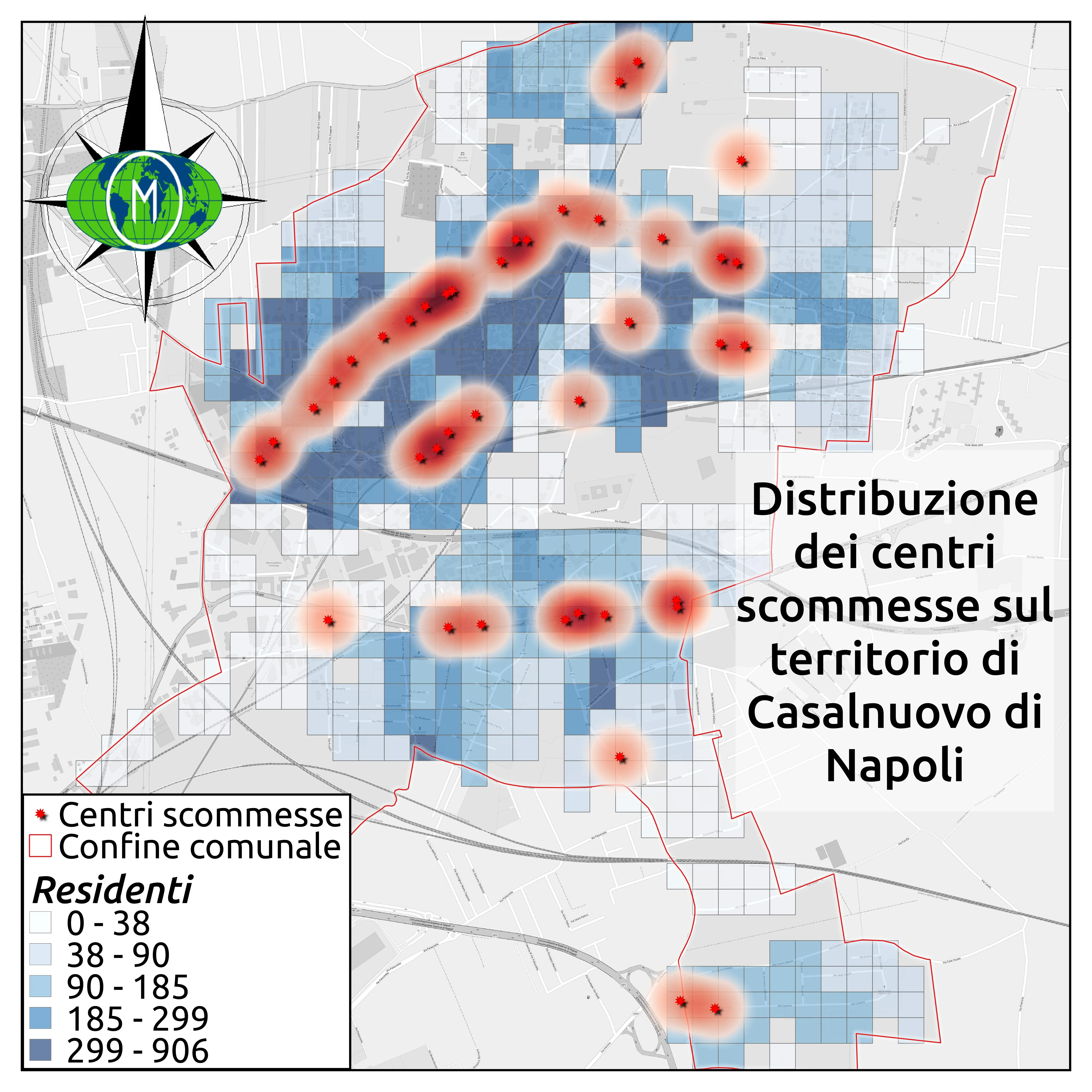
I have considered betting centers in their most basic sense. broad considering as such all the places where a person enters and has a way to bet money hoping to win more. In the betting centers you see on that map there are therefore:
- slot rooms
- bar with slot room
- tobacconists
- betting centers proper
- bingo halls
On the map, each square you see has a side equal to 100 meters and, depending on the presence of residential buildings, can have a density more housing or less high than others. Following geoprocessing operations, I was able to put together the data on buildings, the ISTAT data relating to the 2011 census and this grid in order to obtain the density distribution municipal housing. It's an estimate but it's very realistic.
How can you see as the intensity increases of blue, the number of residents is increasing, particularly in areas with high density of betting centers there is a resident population of almost twenty thousand people, almost one center for every 1500 inhabitants. Among other things, these are also the most densely populated.
These could therefore be potential foci of gambling addiction. Those who govern the territory could put them under observation, activate social policies aimed at avoiding the risk, relocate part of these centers and perhaps convince bar managers to remove the slot machines.
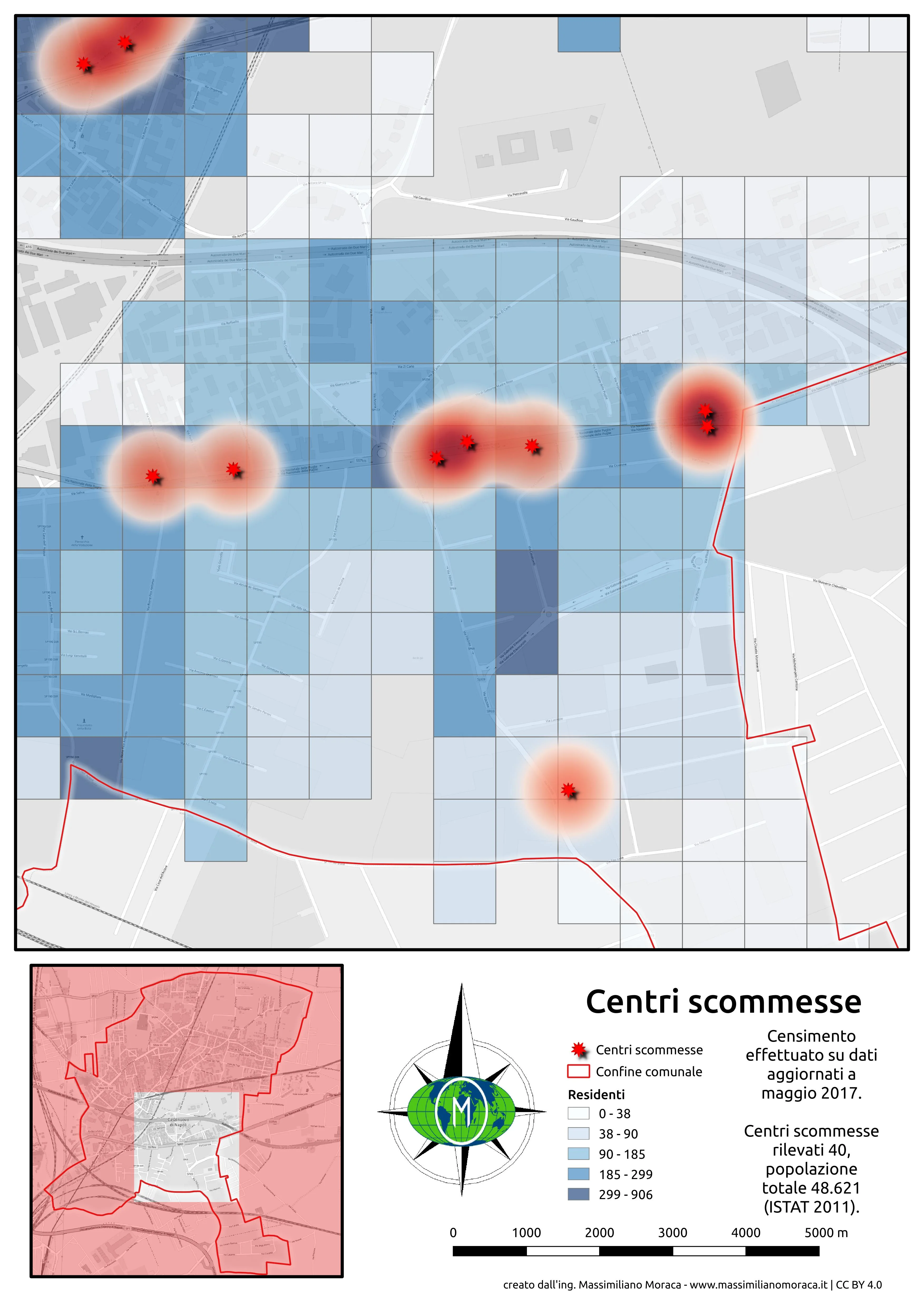
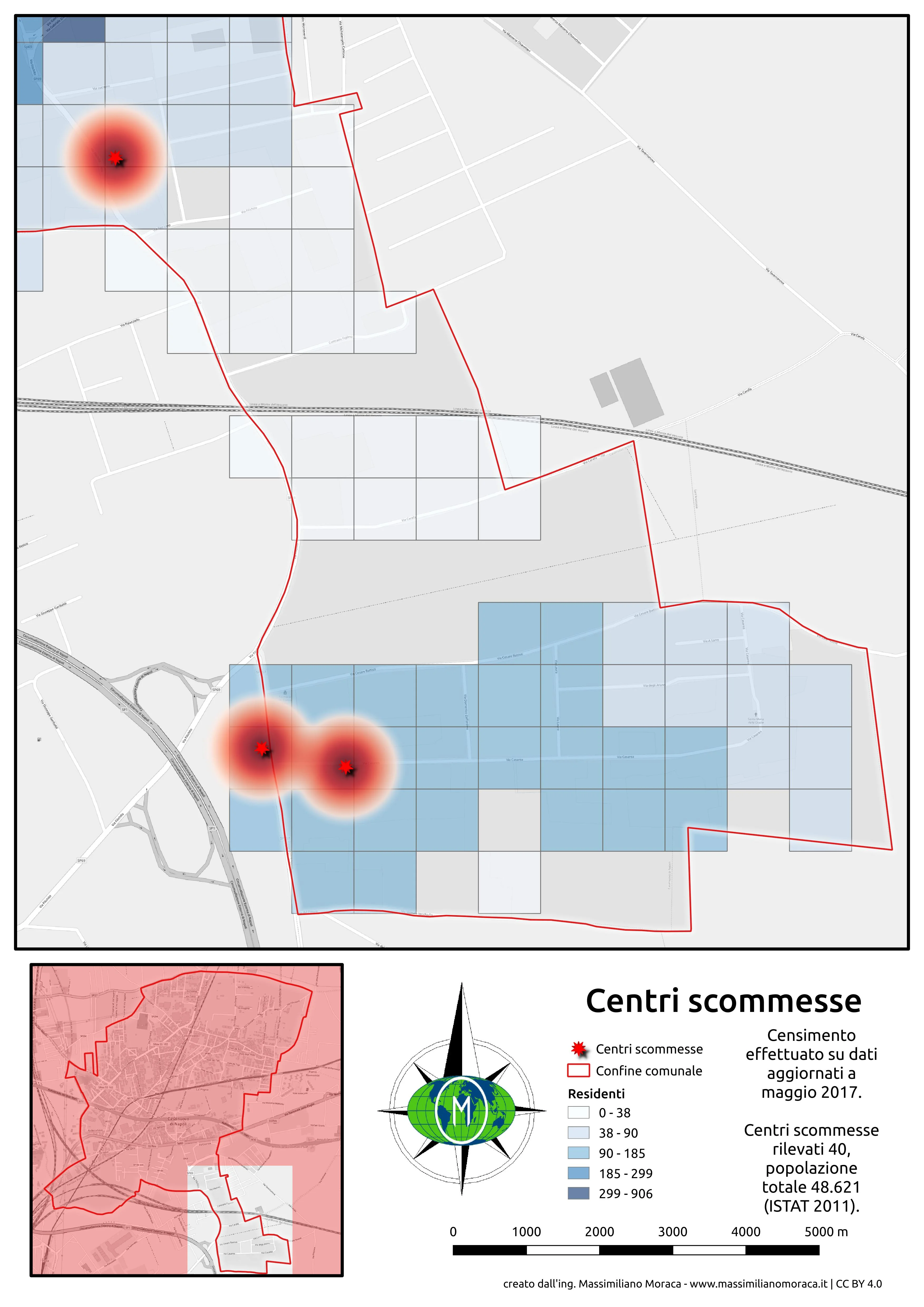
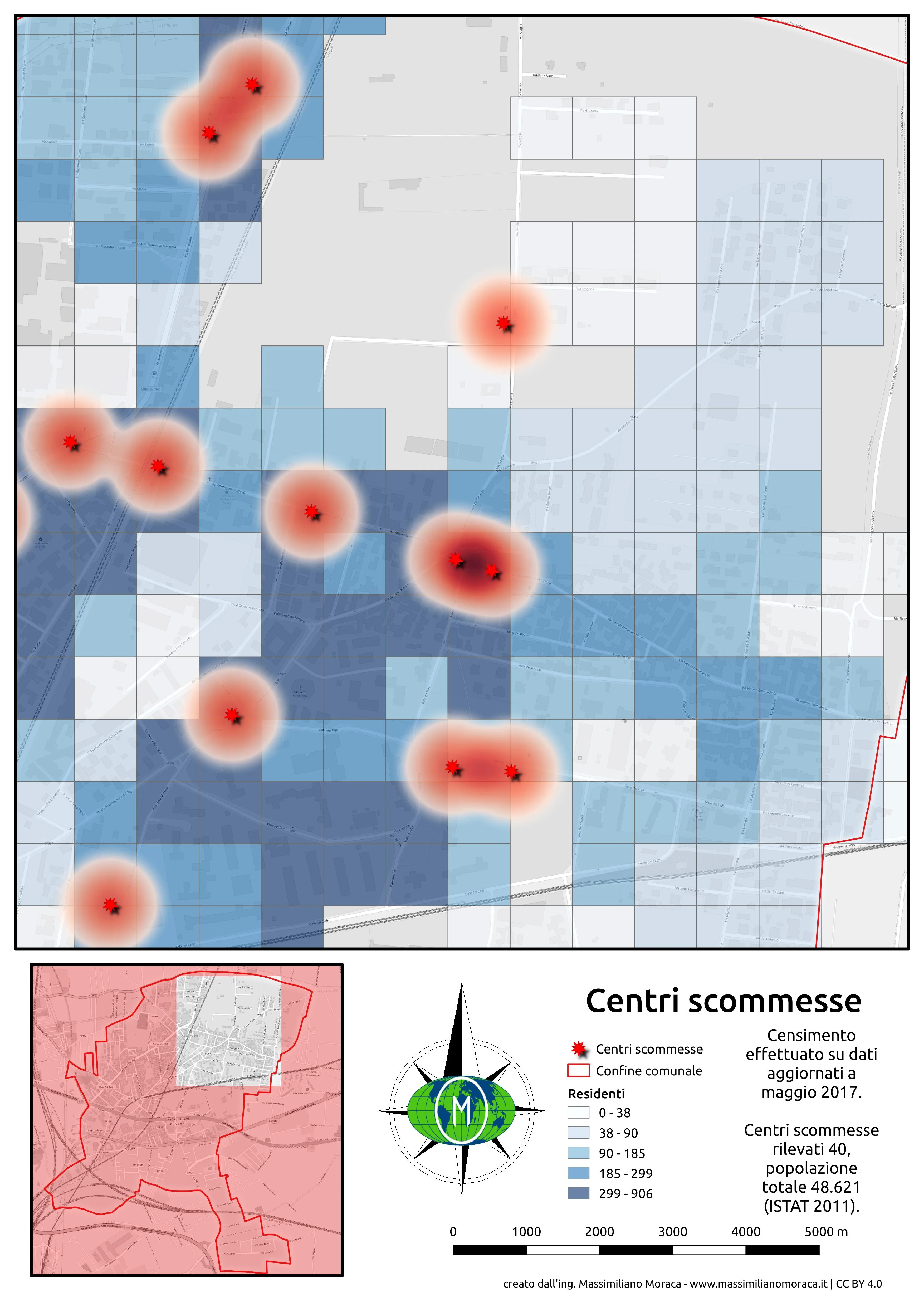
The following images are a closer focus detailed on the municipal territory.