
Archaeology is certainly one of the disciplines that benefits most from the use of GIS tools. Just look at how GIS methods can be used on an archaeological excavation site.
Archaeology and GIS tools can work in very close contact because GIS tools make it possible to survey and catalog everything that comes to light during the various excavation phases, linking vector data to descriptive tables. An interesting example is pyArchInit, a GIS tool created specifically for archaeology.
Let us look at a GIS application in archaeology. Consider the area between the Archaeological Park of Suessola and the Riullo Oasis.
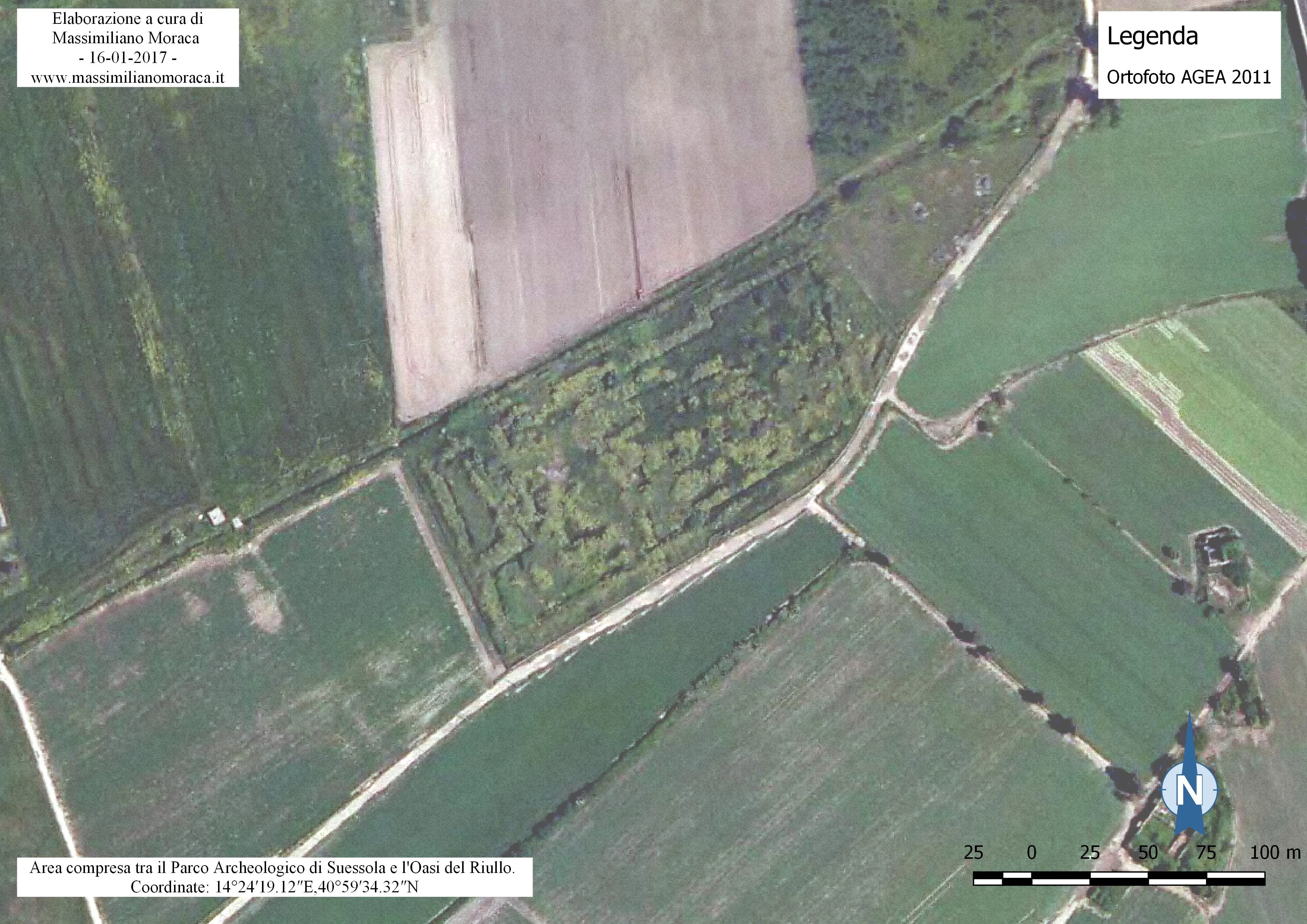
From satellite images, a careful eye can notice unusual marks on the ground, marks that become evident only from a point above ground level.
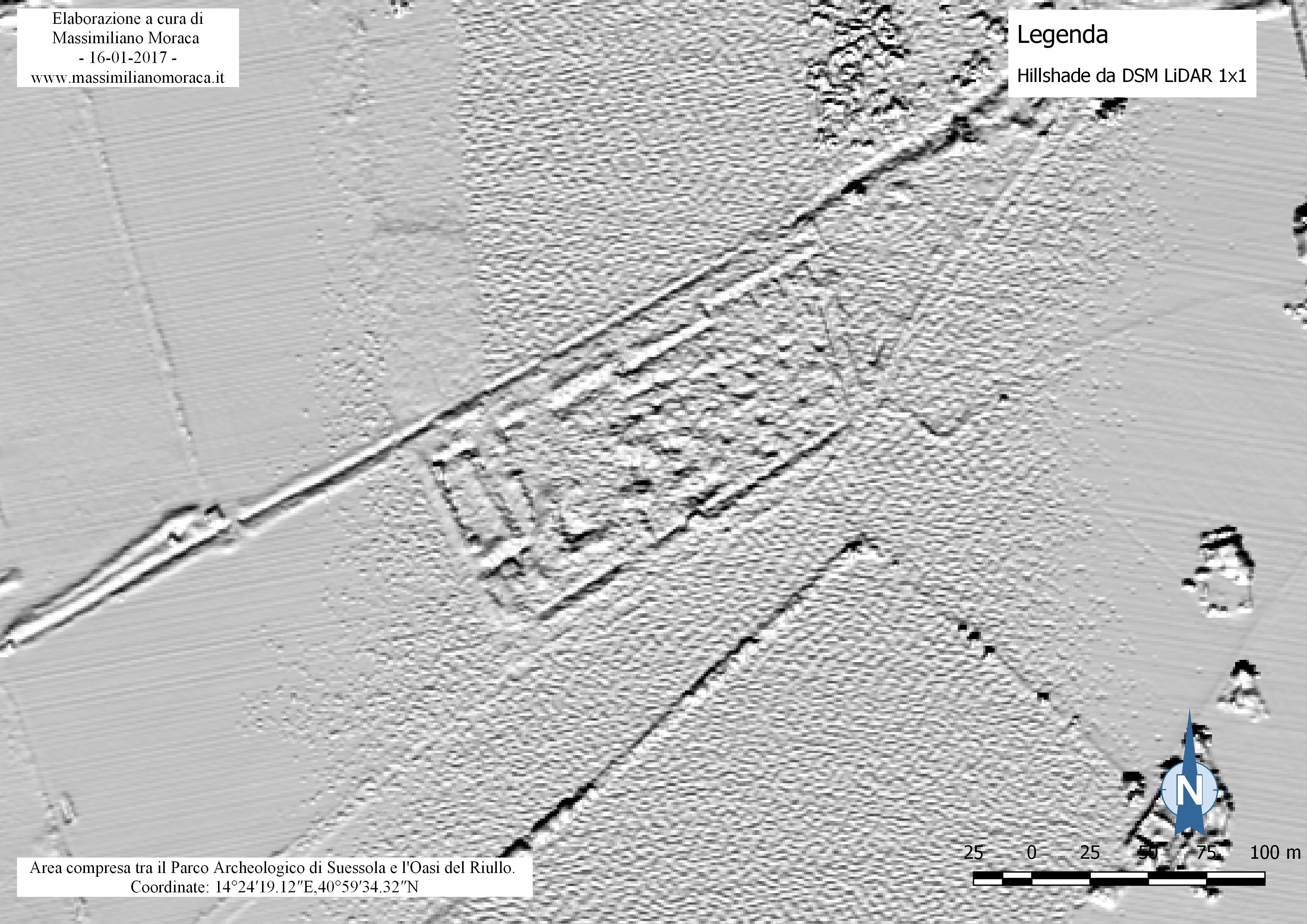
By generating a hillshade from the 1x1 LiDAR DSM, something starts to emerge.
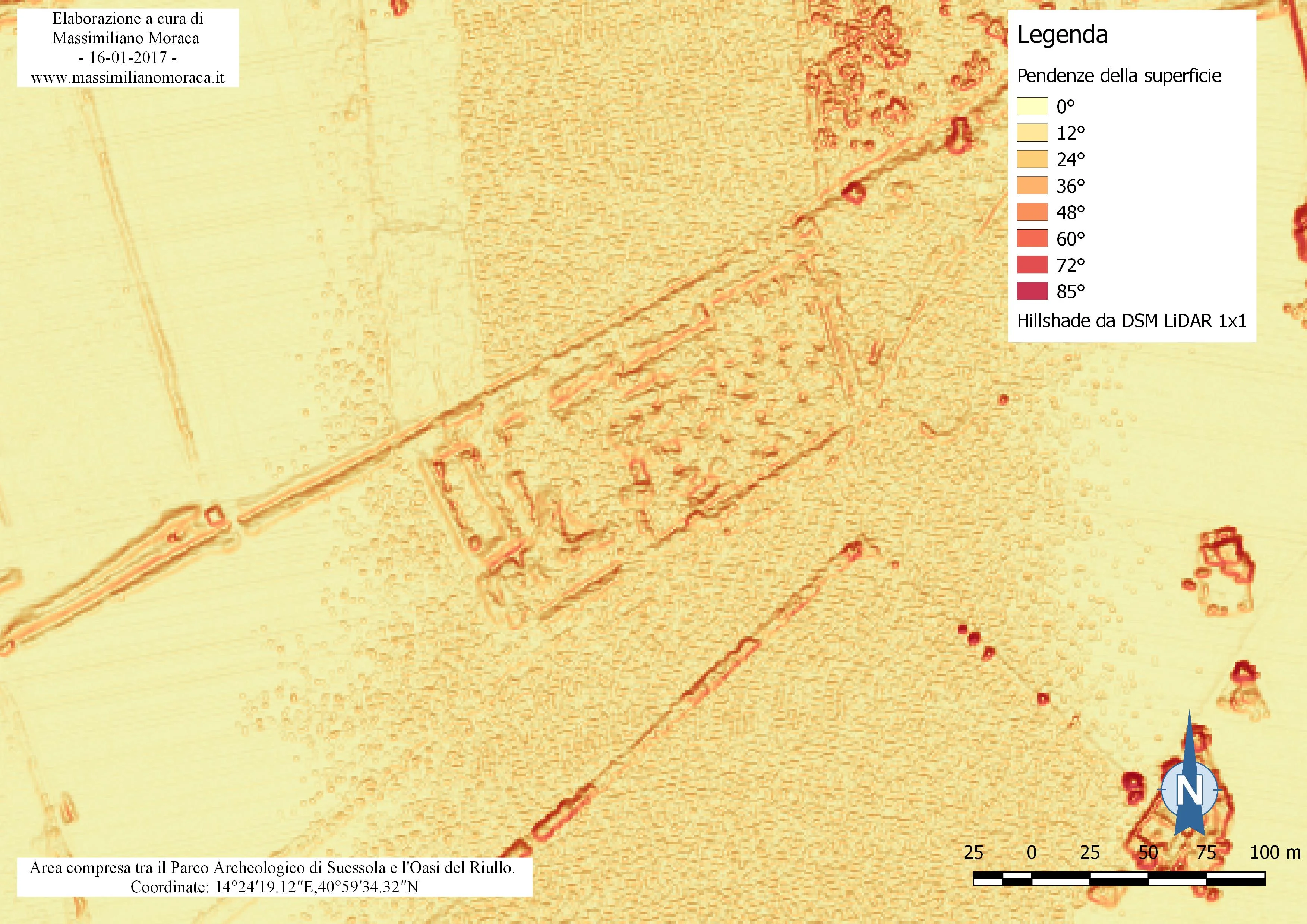
A particular variation in ground slope also stands out when a slope map is extracted from the DSM of the area.
It is a little strange for bushes to grow naturally in a way that creates what look like geometric shapes on the ground.
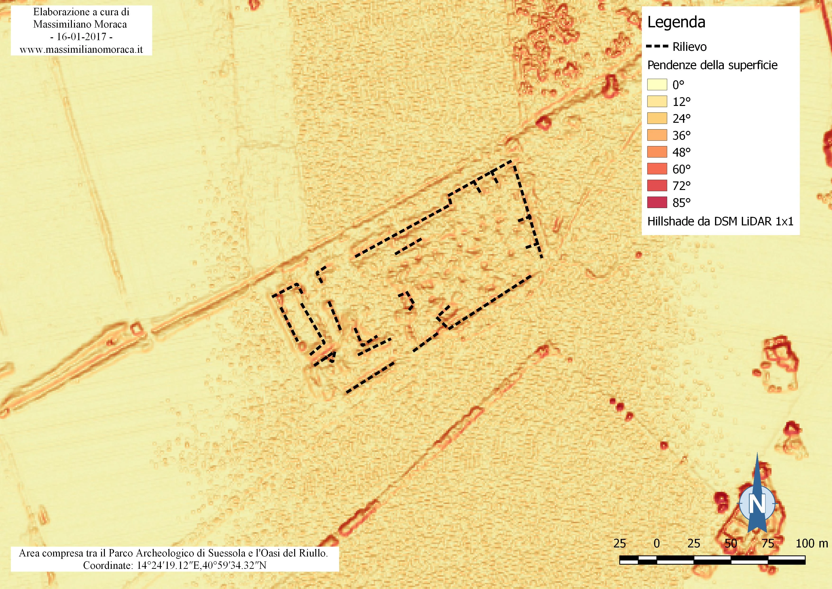
By tracing a few lines, a pattern appears that resembles the plan of a building.
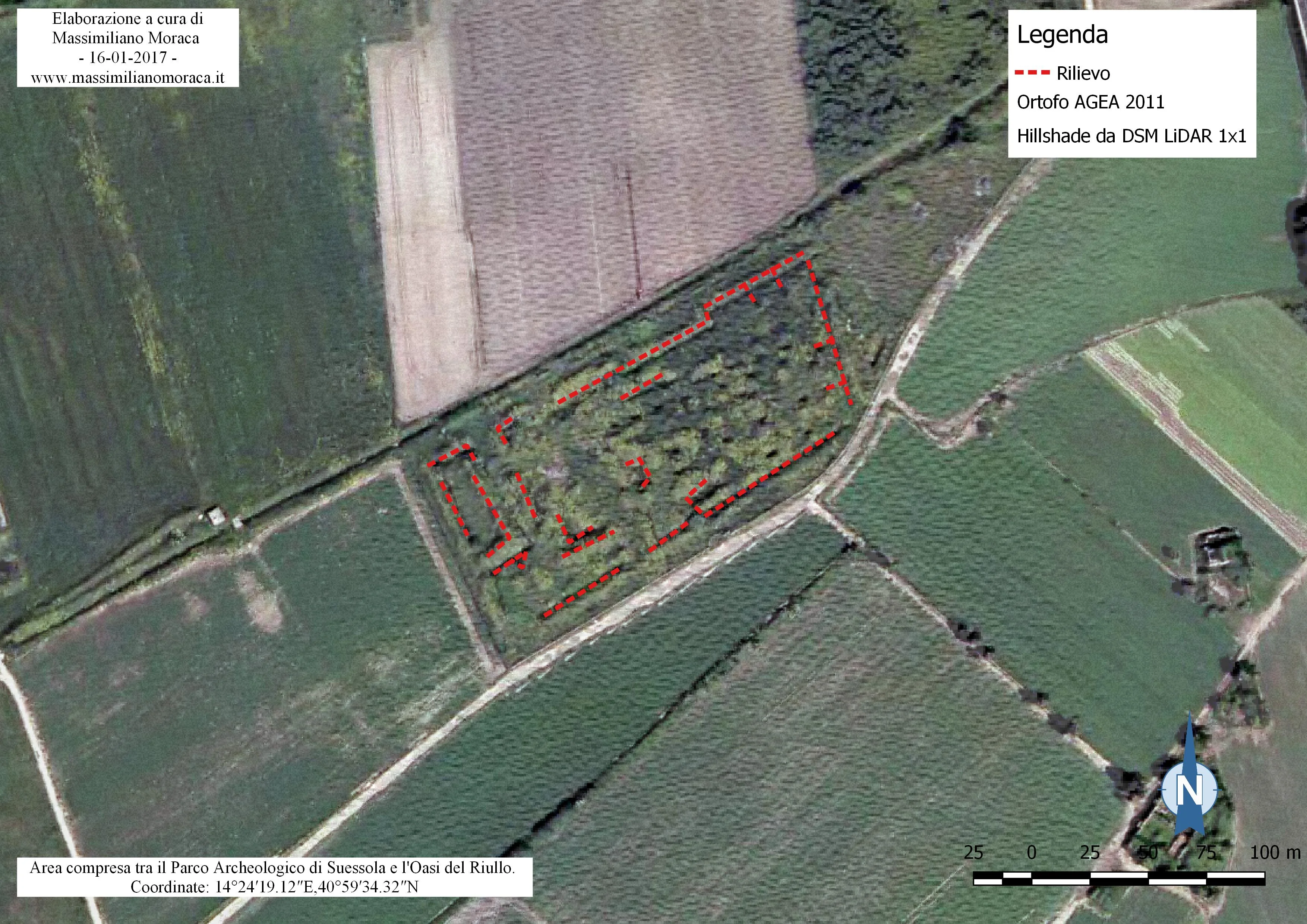
I do not know whether the Archaeological Heritage Authority is aware of this structure. Perhaps it has already been recorded, perhaps it is ancient, or perhaps it is the remains of a modern structure. In any case, by using GIS methods and the appropriate tools it was possible to examine an area and highlight the presence of something that could later be investigated in the field.
Archaeologists who read this article may raise an eyebrow; they certainly have more direct examples that could highlight even better the usefulness of GIS methods and GIS tools in archaeology.